Entries Tagged as 'gps'

Oh noes… not another driving video from #wtrip09

Yes… it is…

this time the drive from Coober Pedy to Adelaide… (I forgot to hit go on one part of the drive in Sports tracker so about 10k are missing from the start of the trip in the KMZ file…)

The Start of the Journey
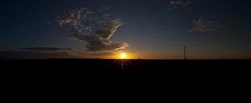
Here is a small panorama I made the morning we were leaving..
Sunrise over the Dugout

The Journey

and watch for the driver change at 3:46 🙂

The Route


View Larger Map

#wtrip09 – The Drive to William Creek, the video, kmz and a picture

I thought I would start with one of the side trips as a blog post for when I got home.. it may take me a while to put all the stuff I have together…

so here we are…

This is the 166k drive from Coober Pedy to William Creek as a 6min video down from the raw 15.4gig 320×240 10fps video of 1hour and 46min.

The Journey

The Route


View Larger Map

The Destination
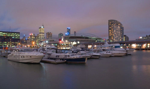
and here is a small panorama I made at the end of the World famous William Creek Pub on the Oodnadatta Track.
William Creek Hotel Pano

KML File came via sports tracker on the Nokia n95-8gb, Pano from my Nikon D90 and the Video care of the usual set up on the Asus R2h

Buy Too Late for the Rains

finally an update about geotagging software

yes.. I know I have been very slack with the blog as of late… but when your job consists of herding cats and then do html templates at the same time it all gets a bit to much. but back to the entry.

I have been meaning to write about this for sometime… and I am sure most of you have heard of it… but hey better late than never.

As you are aware I have a very nice Nikon D90… and boy do I love that camera. But the one thing I do not have is the GP-1 Nikon GPS device (only cause I can’t afford it). However what I do have is the Nikon D90 and my NokiaN95-8gb running sports tracker. Now the great thing about this is… sports tracker not only exports to kml, but also to GPX. And GPX just happens to be the format that Microsoft Pro Photo Tools read.

Fat Cats Playground
And this very clever bit of software will let me take the gpx trace file and point it to my collection of photos from the camera… match up the timestamps and hey presto they are all geotagged.

Now it is not without issues… namely it currently doesn’t write to the .nef files and in Nikon View it will break the pairing of the images. (which is a major downer really)  But it still means I can geotag my shots very quickly as well.

I will be watching the development of this bit of software a lot more closely in the future…  so I do recommened if you have a good dslr and are running software like sports tracker than can export out a gpx file… download it from here

Finally a draft of the #wtrip08 kmz file

yes.. it has taken way to long to do this.. but with work and all the stuff getting in the way of fun…

anyway here is the first draft of the kmz file for the #wtrip08


View Larger Map

Roadtrip 08 – Tech

yes I am a nerd… guess that is why I have my own domain with a blog hanging off it as well 🙂

But that aside I thought I would outline the tech I am taking on the road and why.

Lake Mountain Snow ChaseComputer: Asus R2H:  – Built in GPS, Touch Screen, SD Card Reader
Software Loaded: Win XP.OziExplorer, Nokia PC Suite, Irfan View, NxView (Nikon Software)

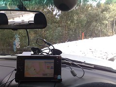
This is the primary tool of the trip for storing and managing all the data.  With this computer mounted on the windscreen of the car I have all the maps, music and photo handling that I could need. (well maybe not all.. but certainly all I can afford 🙂

Hanging of the computer is a WD Passport Drive and a Logitech Webcam to act as a trip recorder as well and a little FM transmitter for music.  (a lot of very bad singing to 80’s music coming up for me!)

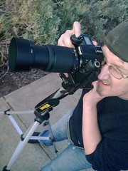
me and the camera. exact geo locationCamera: Nikon D90: with a 18-55mm and a 55-200mm VR Lens kit configuration.  Further I have also purchased for the trip the ML-L3 wireless remote control (hopefully to get long exposures of the night sky outback) and 2xUV Filters for both lens’.  I got two so I can swap my lens’ and don’t need to swap the filter.  The filters only set me back $19each from JB, so that wasn’t a big problem.  I only have 1 4gig SD card (Class 6 rated), but given that I have the computer and a WD Portable HD as well space is not a major problem and I doubt I will shoot more than 4 gig even in RAW in one go 🙂  And the R2H reads the SD HC cards just fine so I can empty a card pretty damned quick if I need to.

Mobile Phones: I am taking two phones.  One my trusty Vodafone powered N95-8gb.  Which will be on the whole trip.  One it will act as a back up gps device and datalogger of the trip as well.  And secondly it will also be used to geotag reference photos when I am away from the car and the UMPC.  I can’t afford the new GP-1 for this trip so I will be forced to geotag manually  (oh the humanity!)  But the phone acts as a great way to get this data in a reference image via the Location Tagger software.  The other phone in a Telstra Next G – Telstra 156 with external antenna (big hat tip to @johnH for the antenna).  This will act as my emergency phone.  People can call into me and I can call out if there is a problem.  From looking at the maps of my route I am down to less than a few hundred k’s of a 2000k trip outside phone coverage.

I have a 150watt DSE Power Inverter to keep all the batteries running as I go as well.  So I can power things up on an as needed basis as well.  I have a car charger for the Nokia so can run that easily and charge the other phone/camera/UMPC on a rotating basis as needed without any additional expenses as well.

So that outlines most things and all the purchases I have made in the last month or so for this trip.  I am not allowed to spend any more money on toys 🙁 but I think I may just have enough to get by for a week on the road by myself.

Macro on the Sun


Macro on the Sun

Originally uploaded by wolfcat_aus

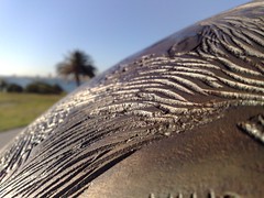
Two reasons for this blog post… 1.. seriously this is one of my better photos for a while. It is a photo that I am happy with both on a technical and an aesthetic value as well.

This is a photo taken on a phone. I do think people need to stop and think about that for a while. We all rush to get the latest tech all the time. I remember the first digital camera I purchased in 1997 (yes I am an early adopter) it had a resolution of 320×240 (and yes I was a poor early adopter) . Now my phone (yes my trusty Nokia n95) has a 5mg camera with an amazing lens that captures photos like this. The other thing to notice is that this photo is geotagged. My phone has my GPS as well. First time I got to play with a hand held GPS was a Magellen Unit back in 2001. Now I am lost (not figuratively) with out one. I used the GPS on my phone to find this particular object that I have photographed here.

So I do think we all need to stop and think what really interesting times we live in.  Now I am reflecting on less than 10 years of tech in the above paragraphs…. consider what we are going to have in another 10!.

And the second point, is the subject.

Artist Chris Lansell has created a 1.1billion scale model of the sun. Not only that but now has been now laid out from St Kilda to Port Melbourne in the same scale the rest of the solar system. From the model of the sun to Mercury is 58 metres, then other 100 or so to Venus, then Earth. Saturn in scale is nearly 2 kilometres away from the St Kilda marina. Poor old Pluto is 5.9km. (all controversies about it status aside :-))

for more info on the project go here. http://www.melbournesolarsystem.com.au/ .

But for getting a sense of scale of our place on the planet you should go and visit the St Kilda foreshore.

Nokia Photos 1.5

Nokia Photos has hit 1.5 (Beta that is) …. (which is kind of amusing as I didn’t realise there was a 1.  But I digress with my lack of knowledge….)

  • Better integration with Share on Ovi
  • Maps view and geotagging: your photos and videos on the map
  • More supported devices
  • Import pictures from also from your digital camera
  • Ovi look and feel

Fully supported: N70, N71, N72, N73, N75, N76, N77, N78, N80, N81, N81 8GB, N82, N90, N91, N91 8GB, N92, N93, N93i, N95, N95 8GB, N96

Partially supported: all Nokia S60 devices and most digital cameras (import pictures/videos only).

PC system requirements:

  • Operating system: Windows® XP (Home and Professional, Service Pack 2 or later), Windows® Vista”

Important! If you are a Windows XP user, you must first update your computer with the Microsoft .NET Framework 3.0 from here. This update is not necessary if you are using Windows Vista

………

So that is the standard hype… here is what I think…

It does things that lots of other things do for my photos already…  yet for me this is the big and very nice kicker… the maps.

And by using the Navtec maps it means I can zoom in nice and close (unlike Flickr) on street level to see where to place a photo that did not get geotagged correctly.  Once you have opened a photo you can move its geodata as well. The one thing that is missing from the Navtec Maps however is a Satellite view.  So what most people would say… but if you have a photo that is not correctly tag and you took the photo in say a wilderness area that is easy to recongnise from Satellite imagery then you can easily tag it, this you can’t do.  I have actually got quite good at this, but that is mainly due to flickr using yahoo maps for Australia which basically suck big time.

The software is not without it bugs mind you.  I am having trouble navigating between images in map mode for example. Also it says it can intergrate with other hosting sites, but it does default to OVI.

Perhaps, just perhaps I will shift a bit more to OVI for my photos as well.  Yet this is a bit of software I think I am about to become very accustomed to.

But if you want to set up Nokia Photos with flickr (and I do)

here are the instructions… (care of http://europe.nokia.com/support/nokiaphotos)

Settings for Flickr:
Note: Flickr requires Nokia Photos to use a special login that is different from your normal Flickr/Yahoo! login. Get your special Flickr login here.

  • Server address: http://www.flickr.com/services/atom/
  • Username: get your special username here
  • Password: get your special password here

I am going to set it up at home simply to use it as the primary way of accessing my photos at home.  The geotagging and maps feature alone mean that I will want to use this over anything else.  The maps are not another application that has to be launched and then data passed back and forth.  They are a tab.

Now I must go and start geotagging 10 years of digital photos….

Location Location Location (did I mention location?)…

http://code.google.com/android/adc_gallery/

“The final phase of Android Developer Challenge I is now complete. Out of 50 teams of finalists, 10 teams received a $275,000 award each and 10 teams received a $100,000 award each.”

First of all I must say congrats to all the finalists and winners but I must say there is a common theme to a lot of these finalists… 90% of them are location based.  That is no small number and given how google have moved from the search to the location business in the last few years you can see how location is the tech of the future.  A future that is now.

Having a GPS in your car is now considered necessary and unless my taxi driver speaks fluent english and drives a black london cab I want my taxi to have a GPS as well.  But now phones are GPS devices with most manufactures putting them in not only high end models but midrange devices now as well.

I geotagged tweets and photos create KML files e.t.c, but soon and very soon there will be tech that says I am here and what is around me.  Some of these Android apps will flow back into the market on other platforms some more than others.

For example Compare Everywhere will change the face of shopping and shopping districts in a very short period of time.  Image a world where you scan the bar code, your phone then looks around where you are and lets you know if there is a cheaper item online or at another store say walking distance away.  This will not be a small shift in how we shop but will result in a fundimental shift on how shops work.  Perhaps even service will make a come back into a lot of these increasingly homoganised shopping malls.  When a store 3 shops up has something cheaper and you don’t have to go there to find out then you will reconsider you purchases.

Sure a lot of people are going to whine about geoprivacy but like all things there are levels at which you can interact and places you can and wont.  My home is my space for example, but lots of people know where I live and people can work out a lot about you even without computers.  Sure it makes stalking easier, but if we pander to the few bad apples then Newton would never have sat under the apple tree and we would have GPS 🙂

Some new photos and KML's

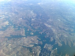
Sydney CDB from 7915 metresBeen up in Sydney for a few days for a planning workshop with the Sydney crew which was all very nice, amazing how much work you can get done in a 5 minute face to face conversation over a nice glass of red (Thanks for the invite to your place Chris).  And got to spend sometime with my sister and by time I mean complete a set of tasks revolving around setting up and fixing various bits of tech in the house.

But that aside… and back to the non work stuff, I managed to squeeze out some photos on the flights up and back and get some new GPS traces for you to look at in Google Earth.

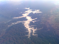
Holding the Clouds in CheckWhen I finish the project at work that is a month late due to my lack of calcium intake and low immune system I will be playing some more with the plug in version of Google Earth and will try and get my KMLS to work off this site directly.  Also hopefully soon my ISP will get off their arse and put PHP 5 on my damned server and I can run some more scripts at this end to show off some of the data I have.

Moon and Earth CurveAnyway click on the images for the bigger versions of these Nokia N958-gb geotagged photos and then click here to download the following KML Files…

Sydney-to-Melbourne-Flight2.kmz and Melbourne-to-Newcastle-Flight.kmz Both of which have the taxi and take off sequence although the gps lost fix due to the rapid climb in height.  They are not the cleanest traces either but getting a fix inside a 737 is never easy, especially when you put your phone into flightmode and then put it away as well.

Canberra at Night This Photo doesn’t look like much at this size, and infact only looks good once you get up to the larger sizes, but it is Canberra at Night. There is a touch of a reflection, but given that I use only a camera phone on Night Mode with the general vibrations of an Aircraft and a few glass of wine before the trip this worked out better value than I anticipated.

Raw NEMA Log File + N95-8GB creation….

I finally found the bit of software I was after for my n95-8b.  It was a raw NMEA183 sentences log generator.  See the Sports tracker logs are o.k.  And yes it does create a very nice KML file for google earth.

But really three is a lot of data missing….  For example..  I can see only the average speed the max and min speeds.  With a Nema Log file I can see the speed and elevation e.t.c at any point of the trip.  Of course you need other software to deal with these files, but I have that from running things like OziExplorer on the R2H.

the software is called eGPSTrack .  A Java App that hooks into the internal GPS and writes all the raw GPS data at an interval that is configurable by the user.

This is from there about page….

eGPSTrack is a gps tracking Java application for mobile devices with J2ME and a Bluethooth , internal or serial gps receiver. It isn’t a navigator, it is a positioning tool that tells you were you are at each moment, and which route you have been travelling. It is primarily aimed at outdoor activities such as trekking, hiking and cycling

eGPSTrack can load calibrated maps (cartographic or satellite images), and show your current track, position and direction on the map, providing you a global view of your trip. Old tracks can be loaded and showed at same time as your current track. Tracks can be exported to GPX and KML files so that you can view and edit them on a computer.”

There are some issues with the software, for example it doesn’t handle the rotation of the screen very well, and occasionally wigs out a little.  But it is a very low version number and it does what I want.  So if you really want to track yourself with your phone, rush out and download this FREE application.

Oh yeah… and one last dig….  Try and do that on your non jailbreaked Iphone… leave a gps task writing in the background whilsts listening to music, making a log file via Sports Tracker and taking a call 🙂  Sorry had to get that in. 🙂