Entries Tagged as 'gps'

And google does mapping as well now.

http://www.google.com/mobile/gmm/index.html

I’ll try this out over the weekend as well. But unless it can cache the maps, it is not going to be a lot of use in Australia due to the horrific data charges that we have in the mobile space.

  • Just Launched! Google Maps on Nokia/Symbian (S60 3rd edition)
    Get a faster Google Maps experience specifically designed for your Nokia/Symbian device, including GPS support for the N95 and other GPS enabled phones. Find out more about Nokia/Symbian phones, or get the app by downloading the SIS or visiting www.google.com/gmm on your mobile web browser.
  • Get GPS-Enabled Google Maps
    GPS functionality
    helps you find yourself (the little blue dot) right on the map.

Map Monsters..

Nokia are really about to push the mapping world and gps judging by this site.

http://www.themapsters.com/preview/

They are doing the whole cute animation instruction manual for building and using maps….  This is going to tie in the with OVI think I put on the blog the other day I am sure.

Whilst it is a bit cutsie for me as a power user I don’t think I am the intended audience for this anyway. But the Flash Animations are worth looking at anyway.

Thanks to allaboutsymbian

Nokia Maps goes 2.0

from the nokia press release… – (once again my comments over the weekend :-))

first comment….  (the bugs I had in the last beta have gone away… the product is usable once more!

and here is the download link as well

http://europe.nokia.com/A4984199

Downloaded over 240,000 times since announced in February, Nokia Maps 2.0 has improved its optional Car Navigation, enhanced its pedestrian navigation, added multimedia city guides, now offers satellite images, and is sporting a redesigned user interface. Nokia’s mapping and navigation solutions give people navigation features, local content and world maps directly on their mobile device, in a way that only connected devices can.
A partial list of the updated features in Nokia Maps 2.0 includes:
DRIVE:
– Improved optional Car Navigation equals PND-level car navigation experience with faster routing.
– Easy-to-use, updated User Interface features including a new navigation carousel with pre-defined navigation views – i.e. navigation, arrow, bird-eye.
– Top-of-the-line navigation features: signposts, multi-stop route planner
WALK:
– Optional pedestrian navigation efficiently walks you from A to B with visual guidance. It helps you to locate yourself by giving information about the surrounding buildings, streets and parks and, if the device supports it, notifies the direction you are walking.
– Nokia Maps 2.0 includes public transportation information (station entrances) data in 17 cities with localized icons for stops.
– Advanced multi-sensor positioning using A-GPS, and pedestrian orientation using the compass feature (Nokia 6210 Navigator needed for built-in compass usage)
DISCOVER:
– Satellite images with hybrid rendering overlays for selected cities worldwide provide real aerial views on your mobile.
– Signature “one-box search” allows you to search through places, addresses, restaurants, nightlife, outdoor, accommodation.
– New premium multi-media city guides including features photos, video, audio streams.

Lake Mountain Snow Chase

I don’t think this will give an accurate
temp
Lake Mountain Snow Chase


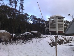
I finally managed to have a little spare time over the weekend so go to indulge myself in one of my strange little habits… Weather Chasing 🙂

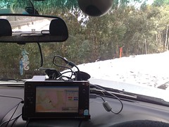
Yes I drove for 300k’s just to see some snow, take some photos and drive back again. Yep, I am that strange. However it the spirit of nerdom I have the following… geotagged photos (link to flickr set), a kml trace (showing the route home only, I have a proper track file from the R2H but haven’t converted the raw nema data yet and given that apart from a bit of the city the rest of the trip is the same anyway what does it matter) and I will in the next day or so try and compress some of the video that I made of the actual drive (Video is up on youtube… keep reading below). The video being a complete capture of the trip at 10fps at 320×240. The only reason they are this small is that the portable hd I use is only 60gig and so I can fit four hours of video like this comfortably. One day I will get around to increasing it to a 320gig version of the WD Passport then I can get higher res capture.

I also managed to send a geotagged twitter (via twibble) on the way home as well (only because Vodafone don’t have coverage at the top of the mountain). So I think the all round trip to the snow was a technological experience.

Oh yeah and I used the R2H with an FM transmitter for all the music along the way as well. So that was my weekend…. 2 gps’s a car and some snow…. all round lots of fun.

Lake Mountain Snow Chase

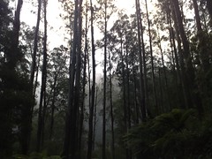
I like this photo just about the most of all the ones I got today
Lake Mountain Snow Chase

This was taken coming through a bit of the road called the Black Spur.

Both of the following videos are just the bit between Healesville, through the Black Spur, Marysville and upto the top of Lake Mountain. There are a couple of stops to take photos as well. The drive through Melbourne is all a bit boring really!)

Video 1 – Up to the Top of the Mountain.

Video 2 Down the Mountain

More geotagging goodness.

Ovi have now added geotagging…

“We have had a lot of questions about geo-tagging capabilities in the forums. Good News! It is now working! Media that includes location data in the EXIF headers will now be displayed correctly on the map. Share on Ovi will recognize if GPS information has been embedded in the photo and will display a map of where the photo was taken. Users without GPS enabled cameras can still add location information once the media has been uploaded.”

So now I still have to work out do I upload to flickr, picassa or Ovi for auto geotagged maps. This is getting silly now. Like most things everyone wants to be apart of the action. At the moment for me, Flickr for photos from a legacy thing more than anything, but I prefer the google maps in Picassa and Ovi is a long way behind. However the push for new mapping e.t.c that they have announced just today may well see me jump ship. The catch is for me is that does OVI become a nokia only space? Will other people with other devices come on over or not. If they don’t I wont either. Chicken and egg I guess.

More from Nokia Maps…

Thanks to Crave

“Planning trips on your Nokia smartphone is about to get a lot easier. Today at Where 2.0, the Finnish cell phone manufacturer announced Maps on Ovi, a Web component designed to complement its mobile mapping software, Nokia Maps 2.0. As part of the Ovi brand of Internet services, which includes the Nokia Music Store and N-Gage gaming platform, Maps on Ovi will allow users to plan their trips on their desktop or laptop and then synchronize (automatically or manually) it with their smartphones. Conversely, if you’re already out on the road, you can record routes and points of interest on your handset and then upload them to the Ovi service when you return home to share with family and friends. The interface on the Web side is similar to what you’d see on your phone for ease of use and a more seamless experience.”

For me it means planning and everything on the dual 24″ monitors at work… uploading to the phone and then driving… plus it has to be quicker and easier to use the computer to refine routes and information that using a phone as well.

Nokia to take over the GPS market.

Given that nokia is now one of the largest manufactures of digital cameras and mp3 players… why not the GPS as well.

http://news.yahoo.com/s/cmp/20080509/tc_cmp/207600908

HELSINKI, May 8 – Nokia Oyj, the world’s top cellphone maker, expects to sell 35 million Global Positioning System (GPS) equipped phones this year, its chief executive said on Thursday.

“We expect to ship about 35 million GPS-enabled Nokia devices in 2008, which is equal to the entire GPS device market in 2007,” CEO Olli-Pekka Kallasvuo told the annual shareholders’ meeting.

Nokia’s $8.1 billion acquisition of U.S.-based navigation firm Navteq, which is still pending regulatory approval in the European Union, is a good deal, Kallasvuo said.

“When we look at it with the eyes we have now, when regarding pedestrian navigation, map services, digital maps, we are even more excited about the opportunities than when making the decision,” Kallasvuo said.

Most phones sold this year go to customers who already have a phone, and Nokia CEO said: “Globally, we expect replacement sales to represent more than 70 percent of the industry’s volume in 2008.”

The Finnish cellphone maker said recently it is set to introduce many new phone models through U.S. carriers in coming months to grab a bigger share of the market there.

Kallasvuo said he sees better times ahead for Nokia in the United States, where according to the research firm Strategy Analytics its market share has collapsed from 20 percent to 7 percent over the past two years.

Nokia Maps Beta Update

(Update 1 – Do not install the new maps via Map Downloader! – The Melbourne/ Australian maps are really really screwy, and make the product almost unusable!, all the water is missing and at various zoom levels the maps are just plain wrong)

Will work out a report for this over the weekend…

(No official change log, but comments at Allaboutsymbian have some details already)

And it looks like some maps have been updated.. will have to see if I can do a right hand turn into my street yet or not!)

http://www.nokia.com/betalabs/maps

Commentsat the Beta Blog here at Nokia

Overview
Nokia Maps is taking maps and navigation experiences to the next level and introducing Walk – pedestrian navigation, in addition to Drive – world class car navigation, multimedia city guides, satellite maps and other innovative features. With free maps of more than 150 countries, over 15 million points-of-interest, the world is in your pocket. Don’t get lost or choose to get lost in the right places to explore, and let Nokia Maps show you the way.

Nokia Maps 2.0 Beta comes with compatible Nokia Map Loader, also available for download from this site. With Nokia Map Loader you can get the newest map data, which is required by some Nokia Maps 2.0 features such as Walk navigation.

Maps 2.0 is still in Beta and therefore not supported by Nokia customer care.

last update for location tagger :-)

This is the update I was waiting for.. but now I have to wait for the firmware version (so that could be a while) seeing as I just got firmware 2 weeks ago 🙂

From Nokia Betalabs tonight…

“I have good news and bad news for you. The good news is Location Tagger has just been updated. The bad news is this version will be the last update on Beta Labs. Instead, location tagging will be integrated into selected future Nokia devices.

What’s new in this release?

  • Persistent log. Now when you exit the application, your list of images in your logs tab will not disappear. When you delete an image from the Gallery of File Manager, the item will also be removed from the logs tag.
  • File renaming. There is additional option in the Settings menu to rename tagged file. The file name will be added _NLT as suffix. For example, if the original file name is image001.jpg, it will be renamed to image001_NLT.jpg. This feature will allow you to easily differentiate between tagged and non-tagged files.
  • Get location from cache. As you may know from our last posting that Location Tagger tags pictures with the last known position in the last 1 hour. If there is no last known position, it will put pictures in the queue until time-out. We added a new feature that allows you to get location from GPS device’s cache.
  • Optimization and some bug fixes. This new version should run relatively faster than the previous one.

Load Nokia Maps on your mac/linux machine.

found this little gem today

Maps for Nokia Maps & smart2go without Nokia Map Loader

Works with any browser on any operating system, including Mac and Linux. No need to install anything on your computer.