Entries Tagged as 'gps'

Geotracing and the #telstradesire

One of the reasons I put down as my interest in the #telstradesire was my interest in Geotagging and Geoawareness…   So here is the blog post covering that…

First things first.. the bad.  There is a known issue with the GPS on the Desire and the Telstra HTC setup.  One hopes that all the people buying the phone from the shop from now on don’t have to do an Over the Air Update to get the GPS working… it needs to ship with the correct firmware. Mine didn’t, but then mine was not factory standard, so I can’t comment on that.

Now on to the good stuff.

WOW… the GPS on the HTC-Desire rocks.  Not just a little, but a lot.  Time to get a fix (even without Cell Tower prefixing) is simply fantastic.  This is the fastest GPS that I have now.  I have 3 others… two Nokia Phones (n95-8gb, N78) and my Asus R2H.. the HTC leaves them for dead.  Time to fix is often under 1 min even when it is a long distance from last fix, strength of fix is always great and it holds it fix very well once you move out of optimal GPS signal range, ie slightly indoors and in built up areas.

Although it took me a while to find the app to suit my needs.  What I was after was something that created either a KML or preferably a GPX file and stored that on the memory card.  No surprise really that the app to do this the cleanest was a Google App called My Tracks http://mytracks.appspot.com/ (See the website for a slightly tacky but helpful introduction.

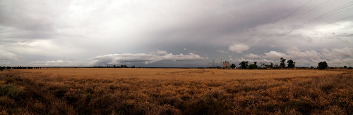
Once I had the app that suited my need…  It was then easy to show a comparison to my most commonly used GPS (the Nokia N95-8gb) and the HTC-Desire.  So what I did was trace the drive into town I do I both devices.  Now they both were set to GPS only (no wifi) and I hit go within a few seconds on the trace.  Also both phones had a fix approx 2km away the night before.

The embedded file can below can be downloaded here.. n95-htc-samples.kmz (right click save as) to show you the detailed path.  The HTC-Desire got a fix before I had even turned the car on.. the Nokia took a couple of minutes to catch up.  To many this time frame may not seem important, but it means I can fire up the GPS on the Desire much faster to get a trace to log my road trips or just to tag photos on a photo walk.

Of course this will suck battery… but once I managed to turn off all the power and bandwidth sucking default settings battery life is once again acceptable.  Whilst the new iPhone may have the ability to do background apps.. the current ones don’t.  And a background task is what is required to do decent GPS logging.  The HTC did that perfectly.  As a test for a some other apps.. on the way home I ran two different background tasks doing logging to see what I would get, what I got was two different trace files 🙂

So here are the traces… Blue is the Nokia, Red is the HTC.  Overall I’d give the more accurate trace to the HTC as well, but I still have to play with the software to get the most out of it.


View Larger Map

This blog post that I did covers how to take a GPX file and marry it to the shots from your DSLR to geocode your photos.

Given that this is a Google App, I really think Telstra should look at including Apps like this on the default setup on the phone, not just fill the phone with apps that are just WAP links.

Missing from the Exif – First post

Thought I would add the some of the stuff from photos to my blog, the sort of stuff that you do not find in EXIF data… the stuff that really makes a photo.

First cab of the rank so to speak will be my sunset photo from the other day…. of course if there are flickr photos you want the story behind, just drop me a line.

The basic shot was planned 3 hours before hand, when I noticed the smoke around the city from the series of burn off’s that the DSE was conducting that day.

Now smoke in the atmosphere will ALWAYS give you a red sunset. And if the smoke is thick enough, you will be able to see the whole disk of the sun with the naked eye, let alone needing ND Filters.

So I know it is going to be a great sunset, so I get home from work grab all my gear and head to my favourite place where I know that I can get the sun setting over water every time. Before I go however I have I quick scan over my flickr sunset set just to make sure I have the approx F Stops and Shutter speeds for similar photos in my head.

When I got to my location, I like always fired up the GPS on my phone to create a log file so that I can tag the photos… and because I am shooting the sunset swap to my 70-300mm lens. I’m after the sun as big as I can get in the shot (well at least very large, so am looking at the 200mm+ range)

Also I have my Hoya 62mm Circular Polariser on my lens. Now I have the cheap 70-300mm which has the problem that the front element rotates on focusing, meaning that you have to tweak the Polariser every time focus changes.

So that kind of covers the technical side of things… then that bit of luck comes into play. There was a boat with a wake boarding moving up and down the bay right opposite the outcrop I was standing on. This shot was the 4th shot I took of them.

As this shot is all manual, this is what I did. I took a practice shot of the sunset to make sure that the colour and lighting were correct. Then as the boat passed left to right I got a focus lock (single point – centre left) on the wake board rider. This gave me the opportunity to check that the first time they went passed that I could get the shot I was after. By now I already knew how far they would travel and when the return trip would be.

Next is that moment of fear… will they pass through my shot again… will they fall off, will they do something unexpected.

Lucky for me…. They didn’t… it all went to plan. I’d also put the camera into highspeed burst mode so that I could shoot more frames that I needed to capture the action. Given that it took the rider less than a second to pass through the sweet spot of the image I wanted to give myself every chance. As the rider got close to the the sun I made sure that I had focus lock on him and just panned the camera as he moved from right to left.

The biggest piece of luck however was when the rider decided to jump. Just before the reflection of the sun from my point of view.

So that is how I fill a blog post writing about a lucky image that took a lot of understanding to get.

So look at the EXIF data of peoples shots to see how the shot was done.. but really… look at the photo and that will tell you how it is really done.

(also you will find this image on Redbubble, with the Lat Long on the final image, where you can buy it from a post card to a framed print)

(oh nearly forgot)

Here is the EXIF Data:

Camera: Nikon D90
Exposure: 0.002 sec (1/640)
Aperture: f/5.6
Focal Length: 200 mm
ISO Speed: 250
Exposure Bias: 0 EV
Exposure Program: Manual
Date and Time (Original): 2010:03:25 19:12:24.00+11:00
Metering Mode: Multi-segment
Exposure Mode: Manual
White Balance: Auto
Digital Zoom Ratio: 1
Focal Length In35mm Format: 300 mm
Scene Capture Type: Standard
GPSVersion ID: 2.2.0.0
GPS Latitude: 37 deg 53′ 57.12″ S
GPS Longitude: 144 deg 59′ 2.35″ E
GPSAltitude: 9.5 m
Creator Tool: Adobe Photoshop Lightroom
Lens: 70.0-300.0 mm f/4.0-5.6

Geotagging without a dedicated GPS on your DSLR

Now of course this works for any camera digital camera not just high end DSLR’s.

I guess people are going to say but who cares about Geotagging photos.  That is easy… say you are on a once in a lifetime trip heading to some out of the way places or even just around town.  You take that great photo of a beach, a wall or even a person… now in 6 months time are you going to be able to find that location again are you even going to remember where it was roughly…    This is why I geotag my photos.  I can now find any location for my photos from the last 3 years, because all the photos have it stored in the Exif data.

I am going to show how using the GPS built into my phone running in the background I can do this.  So you people with phones that have a GPS that can not multi-task will have to spend some money and get a logger to be very accurate. My Nokia N95-8gb runs Sports Tracker in the background just fine so this is what I am going to use as my example. Then by using software called Geotag will add lat long and altitude to all the images, before they are uploaded to flickr.

The biggest advantage of Geotag however is that it will add the data to the RAW files as well as the JPEG/JPG files.  Formats include ARW (Sony), CR2 (Canon), DCR (Kodak), DNG (Adobe), ERF (Epson), MEF (Mamiya), MRW (Minolata), NEF (Nikon), ORF (Olympus), PEF (Pentax), RAF (Fuji), RAW (Panasonic), SR2 (Sony) and SRF (Sony).

Geotag should run on any operating system for which a Java SE 6 runtime is available.

Of course you can just manually add lat and long to say Flickr or Picasa but if you have a big set of photos or have travelled a long distance in a few days it is always easier to get software to do it all for you without having to guess locations.

First Step.. and most important... Make sure that the time on your Phone and on your camera are as close as possible. The software works by comparing the time stamp of the photo to the time on the track file.  You can set offsets for it.. but it is just easier to get it right in the first place.

Always switch on the logging software on your phone and wait for it to get a fix.  If you just fire up the software and hit the road and start driving it can take a much longer time for the GPS to get a fix than if you are stationary. Once you are happy that the software is working you are good to go.  Another tip is to break up a journey into a series of smaller track files, that way if the software crashes you still have a large part of the trip as a log file.  For example when I have been on my road trips I’ll often stop the GPS and start a new track when ever I got out of the car to take photos.

So lets dive in…

Getting the Log File to Geotag.

Open Sports Tracker, go to Training workouts…

Select the date you are after.

Now find the first track file you want.


Then Choose, Export, then Export as GPX. Most GPS Log file software programs handle GPX and this format contains all the info you are after.
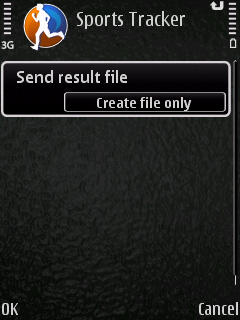
Then Choose create file only.
It doesn’t matter what drive you put this on.. so often Root Drive is just faster especially if you have a few track files to create.

.. Repeat as needed :-) …..

Then once you have all these files simply drag and drop from your phone on to your computer so then we can move to the next part of the process.

Once you have opened Geotag choose File > Load Tracks From File.

This will let you select all the small tracks files that you have created in one group so you don’t have to open each track file on its own.

Then you can either open up just the image files or a whole directory.  I tend to just import into Lightroom, do a quick pass to delete the dud shots, then tell GeoTag to look in the directory from the last import and work from that.

Now with the Track Files and the Directory Open, you right click, choose Find Locations > For All Images.

At this point a cup of coffee may be required if you have a few thousand images…

Once it has finished processing you will have all your images that the gps was working for tagged…

Then just choose Save All and you are done.  Now your RAW files and your Jpegs have the correct geodata embedded into them, so any time you upload to a service that supports Geocodes your photo will be mapped automatically.

You can of course get GeoTag to look up information such as lat, long, altitude, place names or get it to guess locations based on missing parts of the track file.

Another trick is to take one photo with your phone that is geotagged and then copy that information to the rest of the photos.  This is great trick if you are in just one place.  As another trick before going indoors take a photo of the front of the building, then use that as your tag if you cant get a GPS signal indoors.

Of course the easiest thing to do is to buy a GPS for your Camera, but if you don’t mind spending a bit of time the above steps should save you a bit of time money and still give you what you need.

(PS, I still have  dedicated GPS for the camera on my to buy list.. but I am a bit fussy like that :-))

Storm Over the Field

Taken at: 26°38’11″S, 149°54’29″E

#wtrip09 Quick Facts and Figures

Been home a week now and busy sorting out KML/GPX Files, dealing with photos and putting all the camping gear away.

So here are some of the facts and figures from the trip 🙂

Red Earth, Blue Sky Country

  • Minimum distance planned for the trip: 4,203 km
  • Total distance (that is door to door): 5025KM
  • Total Cost of Petrol: $623.24
  • Total Litres: 491.17
  • KM/Per Litre: 10.23
  • Most Expensive: 138.9 BP Cunummulla
  • Tweets where I wrote in the Lat/Long: 48
  • Early MorningPhotos: 5000+ (including family Xmas day ones)
  • Percentage of Photos Geotagged to within 20Meters: 95
  • Hardware Failures: 1 320 WD HD Drive… Rooted when we stopped in Canberra (MBR error)
  • Roadkill: 1 Bird (countless insects)
  • Near Miss: 1 Emu (missed by 30 cm or so)
    Driving into Rain (B&W Version)
  • Total Distance of Video for the trip: Approx 3300km (will try and rescue another 500km of video yet)
  • Total Distance Recorded as GPX files: 5000km (only one Nokia GPS fail on a small side trip)
  • Number of Twitter followers meet IRL for the first time (Not including a dog): 4
  • Number of Bolt of lighting seen: 4 (number missed because storms hit the day after I left 30K+!)
  • Number of States/Territories Driven in: 4
  • Damage to the Car: 1 Stone Chip to windscreen (Location Dual Carriage way just outside Taree of all places!), 1 blown rear power outlet.
  • Most Easterly Point: -28.636305°, 153.637817° (Cape Byron Light House)
  • Most Northerly Point: -26.397385°, 147.176207°
  • Highest Point: 850M -35.275425°, 149.097745° (Black Mountain Telstra Tower)
  • Lowest Point: 0 Meters (Surfers Paradise + Norah Head and other beaches)
  • Longest Distance Between traffic lights (not inc side trips): 1800km (from -35.836815°, 144.907532° which were roadworks in NSW to Dalby in QLD)

Storm Over the Field

I will put together the driving videos and the KML files when I have finished cleaning them up.  Most of the KML files are a lot larger than they need to be as I would leave the N95 running whilst I stopped to take photos and wandered around.

The rest of images I uploaded to Flickr are in my #Wtrip09 Set

Puffing Billy KML File

After living in Melbourne for 5 years I finally got to do Puffing Billy last weekend…. We did the full return trip from Belgrave to Gembrook. And I left my Nokia N95-8gb running with Sports tracker and created this KML file of the trip. You will notice that in places it jumps a bit which would be due to the thick tree coverage on the route.

Enjoy.

Get the KMZ file here as well


View Larger Map

And my fav photo from the trip…

On Guard

See the previous post for video from the trip as well taken on the D90.

New Driving Video (may make you motion sick)

Driving video from the weekend trip to Lake Mountain.

This is the drive home… this time coming via the back road via Warburton through Yarra Junction.  (Where the police pull me over… his question… what was the thing on the windscreen in my car.  The R2H setup I have didn’t look like a GPS.  Poor officer he asked me what it was… didn’t take long for his eyes to glaze over and for him to let me on my way :-). (The standard clip format… R2H video via a webcam under the passengers front visor)

And don’t say I didn’t warn you about the road.  It has the advantage of little or no traffic and is a fun drive and is about the same time and distance as the Black Spur trip as well.

(And the KML)

View Larger Map

And the obligatory shot from the location as well.

Lake Mountain Sunset - 1

The Drive to Bendigo Video + KMZ File

The Video

175K from home to the Bendigo Art Gallery… Video c/o Logitech Webcam and Asus R2H running at 640×480 10fps

The Route as KMZ File

The KMZ File is made via Sports Tracker on the Nokia 95-8gb exported as KML then quick edit it google earth then uploaded to wolfcat.com.au…. you will also find it on the KML Page


View Larger Map

But I don't have all the gear…


The Crossing

Exposure:  5s
Aperture: f/13.0
Focal Length: 18 mm
Exposure: +0.35
ISO Speed: 400

So you have a giant bag of stuff and twenty different lens’, 40 different filters and countless other accessories for the camera and you are lugging them around with you…. but why.

Today’s shot for example… was taken with the D90, with the following equipment the 18-55mm VR Kit Lens, the standard battery and a 52mm filter… nothing more. To compensate for the lack of a tripod and the fact it is a 5 second shot I placed the camera on the ground on the kerb, and held it down with one hand and used my other to trigger the shutter.

I was waiting for the crossing signals to go… so I had already seen the shot… but using no fancy expensive equipment (bar the camera that is :-)) I took advantage of the environment to give me an interesting angle and what I felt was a much better shot. A tripod shot is never going to get a low and have the dramatic foreground that I ended up with.

The technical data of the shot is there as well… all that I did was set the camera to Shutter Priority Mode (S) on the dial and thumb wheel (the back dial) to 5″ to set the 5 second exposure length.

Even the geotagging was done in Flickr… I knew where I was when I took the shot, so just added that later as well.

So sometimes it does help not to have all the baggage you might just get a better shot for it.  (but I still want the gear on my list…. before my wife says no you don’t need it…. for other projects)

#wtrip09 – 3000k of video

Here are all the videos… with a couple of caveats.. firstly I have had to kill some of the post sunset footage.. specifically the stuff when I stopped after dark and then restarted (but in those cases it was still less than 100k of driving for each video). For some reason they have just come out way to dark.

And it is missing the Sunday drive home from Adelaide to Melbourne. It was just to broken and missed a big chunk when my 320gig WD hd was totally full of hours and hours of driving video…. So taking out the 800k for the trip home and a few smaller trips this is around 3000k’s of driving around Australia.

The video was recorded video a logitech webcam mounted under the passenger visor on to a 320gig WD Portable HD via the Asus R2H. The video was 320×240 at 15fps and simply top and tailed in Windows Movie Maker then speed up double until it was under 10min each.

So here we are in order… (see this post for the complete route)

Day 1 Drive Melbourne to Mildura

Day 2 Drive – Mildura to Roxby Downs (Woomera) Via Burra

Day 3 Drive Roxby Down to Andamooka then Coober Pedy

The Big Side Trip – Coober Pedy to William Creek

Coober Pedy to Adelaide

#wtrip09 – The complete route travelled

Here is the complete KML file of the trip… This covers most side trips as well as the main trip up to Coober Pedy via Roxby Downs


View Larger Map

I still have a few more photos to sort and some video as well.. but at least you can see the whole trip now.

Too Late for Rain

The file is made by exported all the Sports Tracker files from my N95-8gb out to Google Earth, then topping and tailing the file to get rid of the junk from each end of the trip that is more often than not just the gps jumping around.

I have the Oziexplorer track files as well.. but they contain even more noise as I would leave the R2H running a lot longer and also it didn’t come on a number of the smaller drives such as the drive to the Breakaways just outside Coober Pedy.