 Yes yes I really should update this blog more often… however between a long couple of weeks at work finishing of a long running project and working on someo other biggish projects and a whole lot of stress I haven’t got around to this blog.
So to keep this post on topic I will talk only about the new camera…
Most of you will be aware of the new camera simply from the my twitter and flickr streams… but I thought I should write a blog post outlining some what and whys…
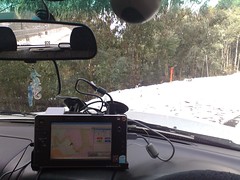
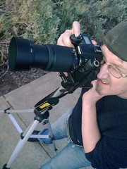
Firstly the camera…. it is the brand new Nikon D90 with an 18-55mm and and 55-200mm lens kit. Now the plan was to buy it in Feb next year so I had it a month before the Avalon Airshow so I could get more photos like the ones I did at the last show where I borrowed a friends DLSR. However the purchase was brought forward for two reasons… firstly the Xmas road trip (unsure if that is going ahead due to car issues :-() and secondly due to the Australian Dollar tanking badly against the yen. The dollar has dropped around 30% in the last 3 months.. so when the current stocks runs out it will be more expensive… and by a lot.
To buy the camera I did a lot of research online… in fact 99.9% of the research was done online and I went into a real shop just to have a touchie feelie experience to see how the camera felt before purchase. So I thought I would share the main links that I found and used.
DPReview – If you want to know a camera inside out and every single detail this is a site you can not go passed. If you are into or even thinking about getting a DSLR make this your first stop.
Ken Rockwell – If you want a plain english guide on the camera its inner workings and what to and what not to buy then this is the guy for you. I looked at a lot of review sites and found the writing style and ideas suited me perfectly.
Lots of sites suggested you get the 18-200mm lens… and whilst I would have loved to have got the one size suits all option the extra $500 I just simply could not afford and that is the reason I went with the twin lens kit version, however if you can spring the extra $$$ I would say yes get the 18-200mm lens.
Now for purchase….
I ended up purchasing the camera through a friends brother who owns a store which sold them… so that is not really fair. But the price I got whilst better than what I found was not that much better.. In my research I had narrowed it down to two places. One an online store and the other an online/store front which a shop in both Sydney and Melbourne. Both of these seem to have very good reputations as well.
Online only: Cameras Direct.com.au
Online/Store Front: Digital Camera Warehouse.com.au
 I will do another entry about the Nikon D90 later about all the tweeks I have already made to the camera e.t.c… But use the above links to do your research and work out what is what before hand.
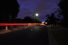
I have also changed the Flickr set on the side bar of the blog to point to the new camera as well. Seeing as the photos that it takes are simply stunning and I am playing with that a lot more 🙂
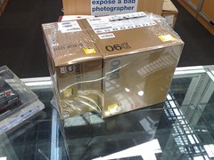
So click here for the Images from the Camera… and click here for the unboxing photos… (all 48 of them)
And I promise I will update this blog more often 🙂
Tags: General, Nikon D90, Photos, RoadTrip 08 by Me
No Comments »